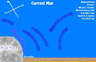
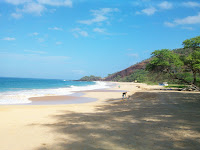
Left: Current Map of Kalepolepo Beach after recording the data of a
floating fruit. Right: Graph of our Beach Profiling data.
Beach Profiling is a method used to determine the transverse profile of a beach. This process is usually done with leveling rods and transect tape. Some physcial factors may affect a beach profile such as high sand dunes and a high tide which would make it impossible the measure the entire beach profile unless you were willing to go in the water to get the data. After storms some physical features of the beach may be unstable or harder to get the correct data due to debris and other things in the way.
This is a picture of Ms. S helping Holly and Lucas at our starting point, we were trying to figure out whether the rise or run tool was at the top of the point. On the right is a picture of Allie and Lucas on top of the dune gathering data.
1. Collect all materials: trasect tape, GPS, compass, rise and run tool (leveling rod), data sheet, and pen/pencil.
2. Once at the beach near the dune you are going to use to gather your data, use your GPS and record the longitude and latitude of the vacinity.
3. Using the transect tape starting from your desired point, lay down a line perpindicular to the water line.
4. Now, use your compass to determine the degree/direction of the transect line laid out. Record on data sheet.
5. Use the run tool (pointing down and along the trasect tape line) and use the level to make it leveled.
6. Now place the rise tool on the opposite end of the run and make sure they are both completley leveled.
7. Look to see where the run tools intersects with the rise and record it at the rise between points A and B. *This number if the dune tilts up should be a negative number.
8. Note any distinctive physical features between the rise and run tools and on the dune.
9. Now move the foot of the run tool at the exact point where the rise tool was located and move the rise tool to the other side to get more data. Make sure the run tool remains level and perpindicular to the water.
10. Complete steps 5-9 down until you reach passed the shoreline to collect all necessary data for your beach profiling.
This is a picture of Ms. S helping Holly and Lucas at
 our starting point, we were trying to figure out whether the rise or run tool was at the top of the point. On the right is a picture of Allie and Lucas on top of the dune gathering data.


